The Global Positioning System (GPS) was originally developed and deployed by the United States Air Force as a military application. GPS is now a U.S. Government-owned utility that provides users with positioning, navigation, and timing (PNT) services. The system consists of three segments: space, control, and user; the U.S. Air Force develops, maintains, and operates the space and control segments.
SPACE SEGMENT
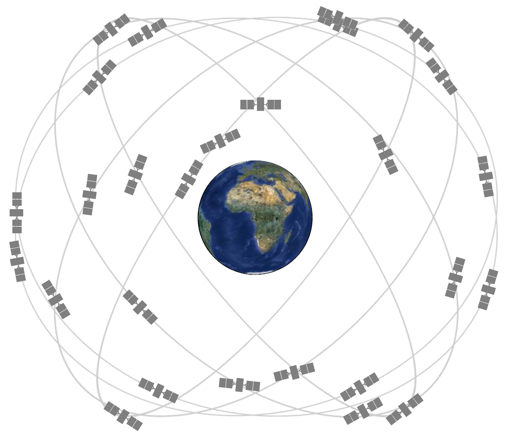
The GPS space segment consists of a constellation of satellites transmitting radio signals to users. The United States is committed to maintaining the availability of at least 24 operational GPS satellites, 95% of the time. To meet this commitment, the Air Force has been flying 31 operational GPS satellites for the past few years. GPS satellites fly in Medium Earth Orbit (MEO) at an altitude of approximately 20,200 km (12,550 miles), and each satellite circles the Earth twice a day.
The Air Force flies more than 24 GPS satellites to maintain coverage whenever baseline satellites are serviced or decommissioned. Extra satellites may increase GPS performance, but are not considered part of the core constellation. The satellites in the GPS constellation are arranged into six equally-spaced orbital planes surrounding the Earth. Each plane contains four "slots" occupied by baseline satellites. This 24-slot arrangement ensures users can view at least four satellites from virtually any point on the planet.
GPS satellites provide services to both civilian and military users. The civilian service is freely available on a continuous, worldwide basis. The GPS satellites orbiting the earth transmit signals that allow GPS receivers to calculate and display accurate location, speed, date and time information to users. The U.S. Government allows companies and individuals to develop systems to augment the basic services provided by GPS by providing increased accuracy, integrity, availability, or other PNT improvements not inherently part of GPS.
A wide range of GPS augmentation systems have been developed in both the public and private sectors. The integration of GPS and Web-enabled information platforms, by companies such as PEGASAT, simplify user access to GPS data. The use of additional computing power, and data stored in memory to display road maps, topographic information and more, allow GPS receivers to convert location, speed, and time information into a more useful display format.